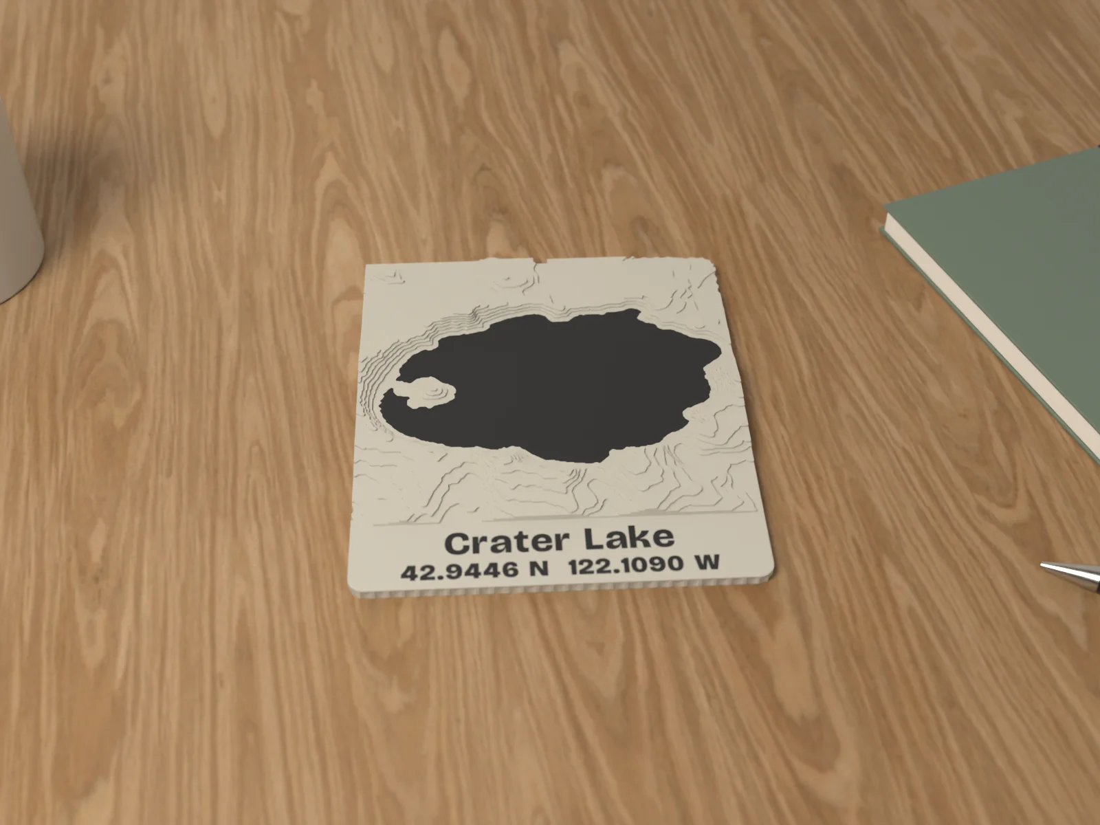
How big is it
150 mm square map plus a 30 mm name panel The map is about the size of a small paperback book cover.
Place Tile
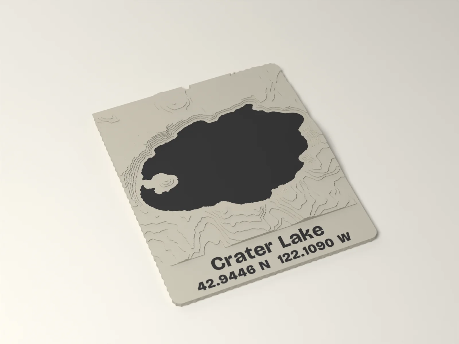
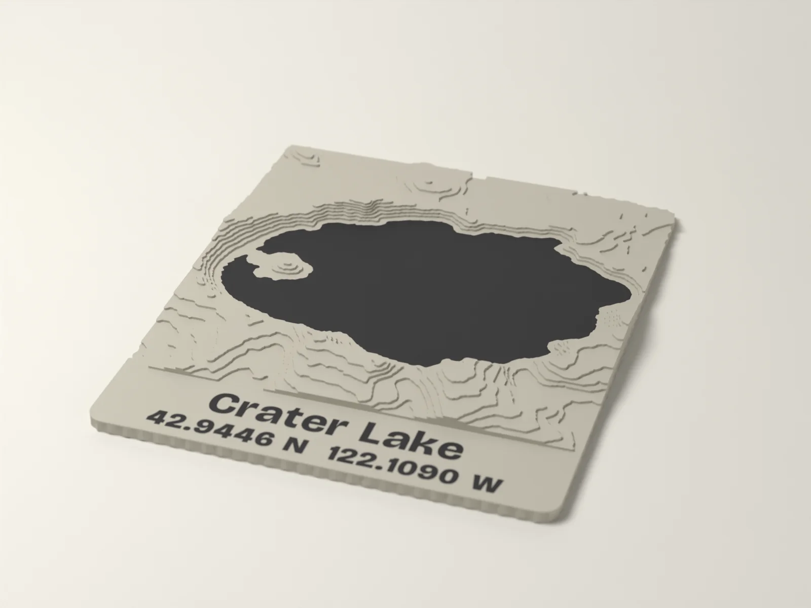
Your real place in stepped contours from US elevation data, with the water inlaid and the name below. US only.
About this piece
Your place, in its real shape. Give us coordinates or a US street address and we build a 150 mm tile of that ground from USGS elevation data, in ten stepped contours you can run a finger over. Lakes and reservoirs are inlaid flush in a second color; where there is no water, the highest ground takes the color instead. The name and the coordinates, or a line of your own, sit on a smooth panel below.
Choose how much ground: 2 km across for a neighborhood or a trailhead, 5 km for a valley or a town, 10 km for a whole lake or a range. We email a preview of your tile before it prints, and print only after you approve it.
United States only, because the elevation data covers the United States.
Elevation: USGS 3DEP
Who it is for
- A first home, a family cabin or the lake you go back to.
- A summit, a trail or a park that meant something.
- A hometown for someone who moved away.
Specifications
| Material | PLA, matte |
|---|---|
| Size | 150 mm map square plus a 30 mm name panel, about 11 mm at the highest step |
| Terrain | Ten stepped contours, 0.8 mm each, from USGS 3DEP elevation |
| Water | Lakes and reservoirs inlaid flush in the second color; with no water the highest ground takes the color |
| Coverage | United States only |
| Data | Elevation: USGS 3DEP (public domain), credited on the tile and the card |
| Size | 150 x 11 x 180 mm as shown, varies with your choices |
| Ships | Within 8 business days, Standard shipping (USPS Ground Advantage, 2 to 5 days after it ships) |
In the box
- One place tile in your colors
- A card with the coordinates and the data credit
Not included
- Roads, buildings or street names. The tile shows the shape of the ground and the water.
Questions about the place tile
Where does the map come from?
Elevation: USGS 3DEP, the US Geological Survey's national elevation data, which is public domain. We credit it on the card and under the tile.
Will I see my house?
No. It is the shape of the land, the hills, valleys and water, not buildings or streets. Flat towns make gentle tiles; hills and lakes make dramatic ones.
Can you make one outside the United States?
Not yet. The elevation data we use covers the United States.
How do I find my coordinates?
In most map apps, press and hold the spot and copy the two numbers, for example 42.9446, -122.1090. Or give us a street address.